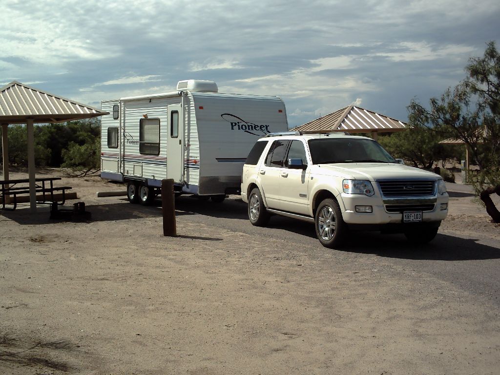
"The Rig".
[Double Click any picture to enlarge. Return with the browser back arrow or ALT-LeftArrow]
I had hoped to get to New Mexico for the first night - about 500 miles, but with the late start I aimed for Balmorhea where there is supposed to be wonderful spring-fed lake. But I-10 is a really dreary road so I only made it to Fort Stockton - just over 300 miles and stayed in a pleasant roadside trailer park.
When I go rafting, I will have to be at the jumping off point at 7am so on the journey I was practising waking up with my wrist-alarm. It worked, I breakfasted, showered (in the campground showers to save putting too much water into the holding tanks) and was off by 8am. I checked out Balmorhea - don't bother going for the lake. Then I nearly ran out of gas again - obviously I was going to have to be more careful in my planning.
Next stop was an hour in El Paso. The shopping and people were a strange mix - a definite, dirty border-town feel but with nice, new civic buildings. The drive along the Rio Grande was rather interesting. First of all, this major river was a muddy trickle. Secondly, there were floodlights all along two, parallel, 6-ft, razor wire topped fences and a border patrol car every hundred yards. If they have to do that during the day, I wondered what would happen at night.
As I was parked, having found two adjacent parking meters not too far from the city center, I decided to have a cup of tea. That didn't work too well because the parking meters did not have a water hook-up! I stopped at the next shopping center and bought a couple of gallon jugs of water so I would be self-sufficient.
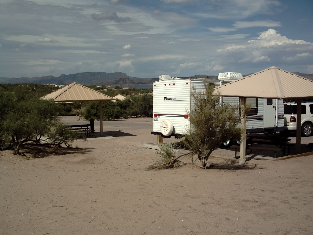
The Campsite. You can see, if you have a strong imagination, a reclining elephant facing to the right. It is just to the left of the trailer
The weather was very threatening - lightning and a gusty wind - but it didn't rain. I walked down to the reservoir, discovered rabbits and jack-rabbits galore, and found coyote tracks. The showers at this campground were 'alternate fuel' - i.e. sun-warmed. By morning the sun-warming had disappeared so I figured out how to light the water heater in the trailer (turn on the switch that says 'HTR') and had a good shower in the rather cramped bathroom in the trailer. I also discovered how to monitor the water levels in the various tanks - it's a pretty smart trailer - and found that I had over a half tank of drinking water. I don't know how old the water is, so I won't be drinking it until I have been able to use chlorine on the tank. The morning sky, as I left, was beautiful - all red streaks - at 8am. It was actually 7am because I was now on mountain time, but I hadn't taken the time to change my watch.
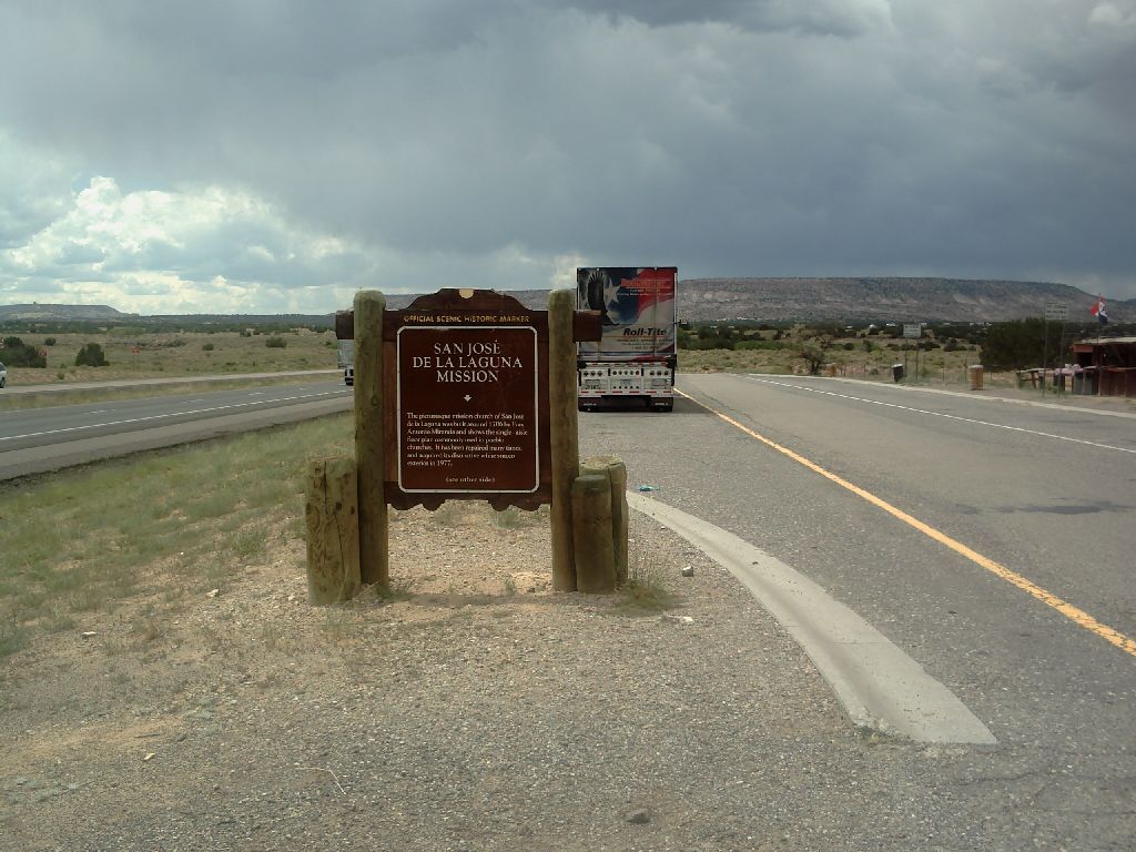
I discovered a facinating museum. A world-heritage site for the Camino Real. This is a must-visit. Before New Mexico was part of the U.S., a trail was driven from Mexico City to Zacatecas, that had very rich silver mines, to El Paso and up through the Rio Grande past T and C to Albuquerque and Santa Fe. This was one of the Camino Real's. Between T and C and the museum the trail left the river and went across the desert to avoid rough country. It took 4-5 days to cross and it was called Jornada del Muerto - journey of the dead. http:\\www.caminorealheritage.org .
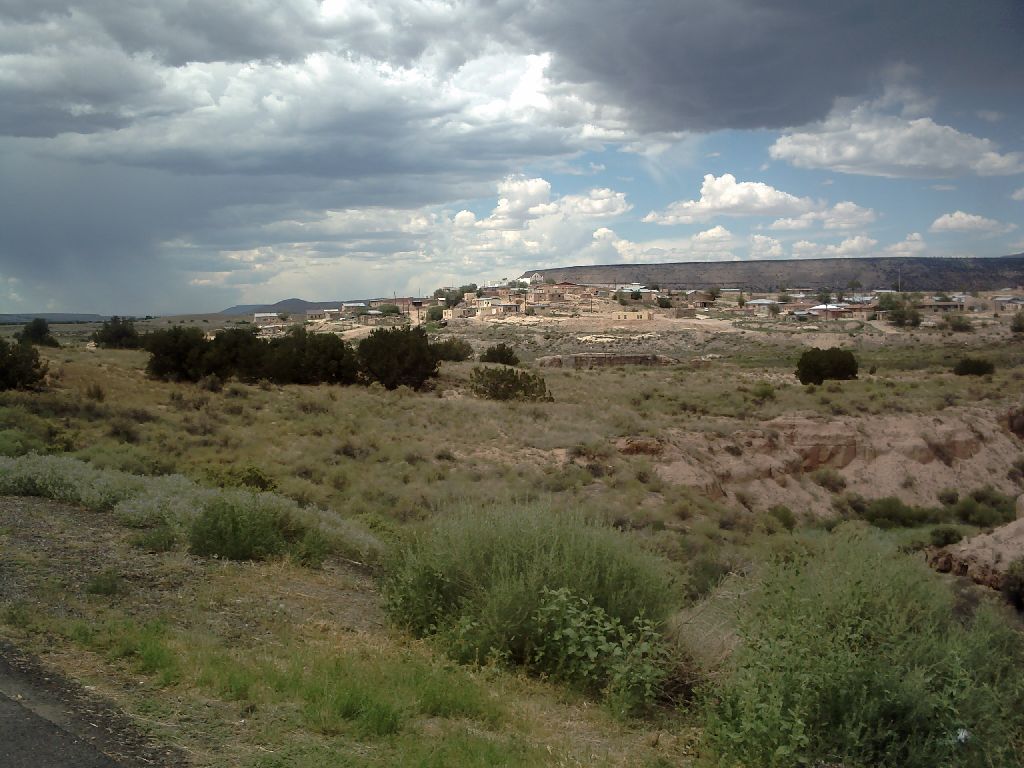
A little further up the road I went through the little town of San Antonio, NM and on to Socorro. This has the distinction of being a semi-major town without a Starbucks. I was really feeling a need for a Latte but not enough to go for gas-station latte machines. Luckily a smaller town up the road was appropriately equipped.
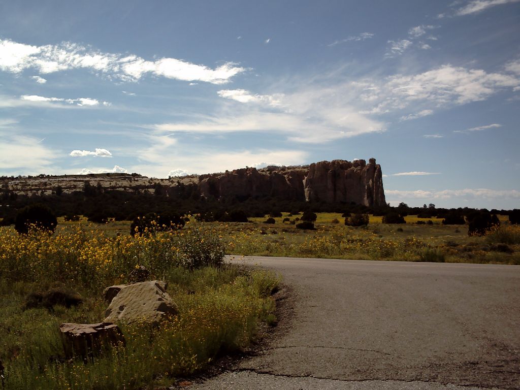
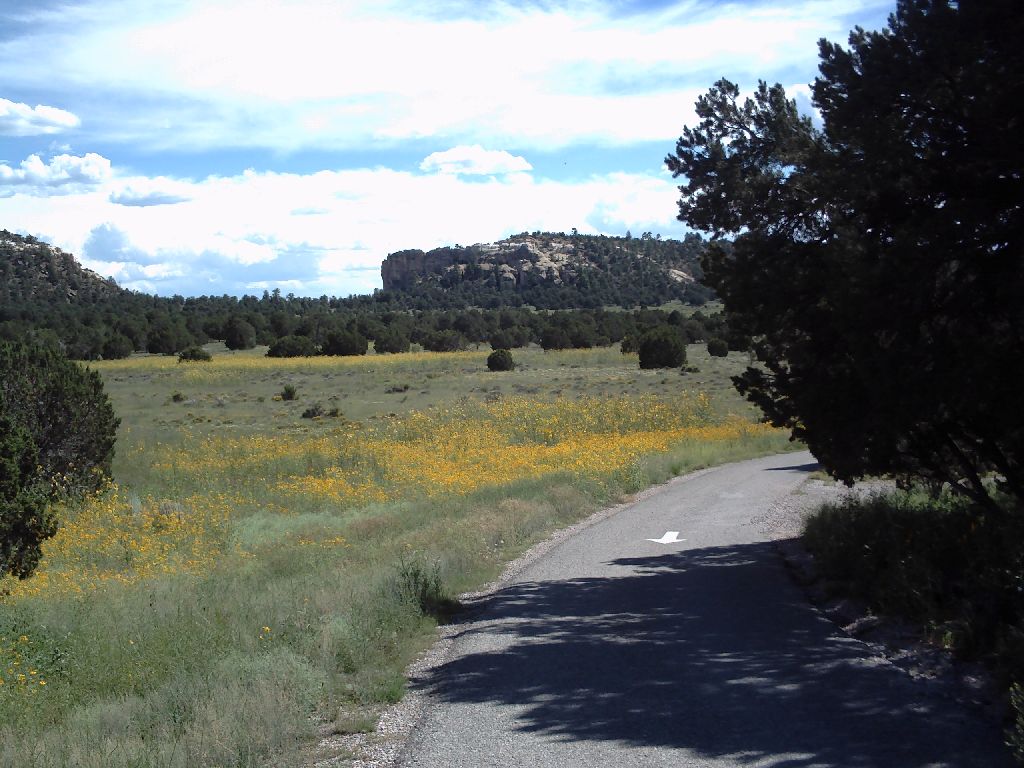
I stopped at the New Mexico Tourist Center in Grants because I knew I was getting into interesting country and I wanted to make the most of it. I quickly replanned my route and ended up at El Morro National Monument. This was Thursday late afternoon so I made the command decision to stay at the Park. The sites are absolutely beautiful. They are very roughly hewn out of the hillside and have neither water nor electricity. Still, I knew I had water for a shower, I have the HTR switch, I have a couple of gallons of drinking water and I have a beautiful site for $5. What more could I want? Hint - it's 97F and the air conditioner does not run on propane. As the evening wore on it got cooler and by morning I had discovered that the central heating works on propane. The campsite altitude was about 8,000 feet. |
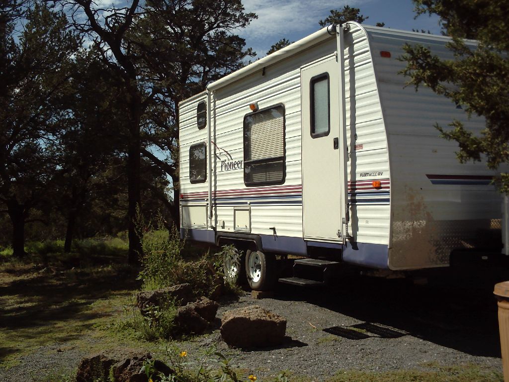
El Morro....... The camp site with props under the trailer wheels 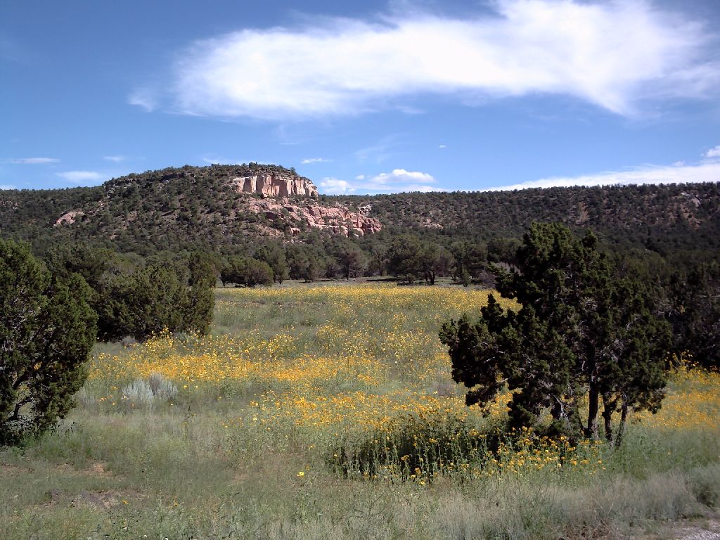
Views from the campsite |
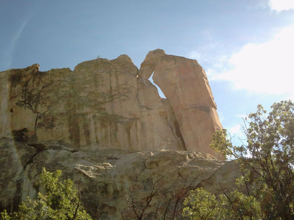
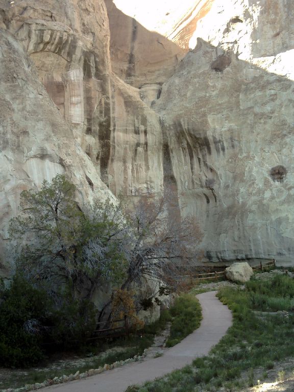
Before dinner there is just time to visit El Morro - the Headland. It's an outcropping of rock maybe 250 feet high. The rangers are carefully monitoring the end of the headland. It has several fascinating features. |
|
| First there is a pond. It is filled by snow and by rain and never goes dry. This was known to Indians and to travellers on the Camino Real. |
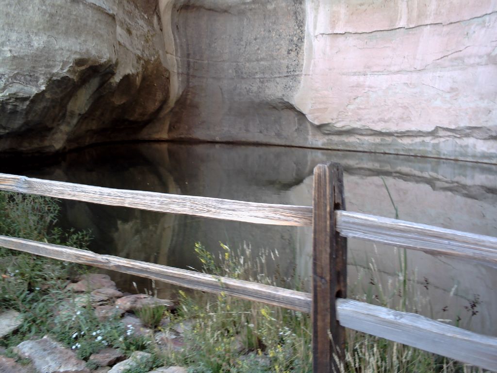 The Pond The Pond
 Cliffs above Cliffs above
|
Second the sandstone is ideal for carving and the pond attracts visitors. The carvings range from Indian pictographs; to Spanish Explorers who carved their names before the Pilgrims landed on the other side of the country; to US Army Officers who were put in place to protect travellers. |
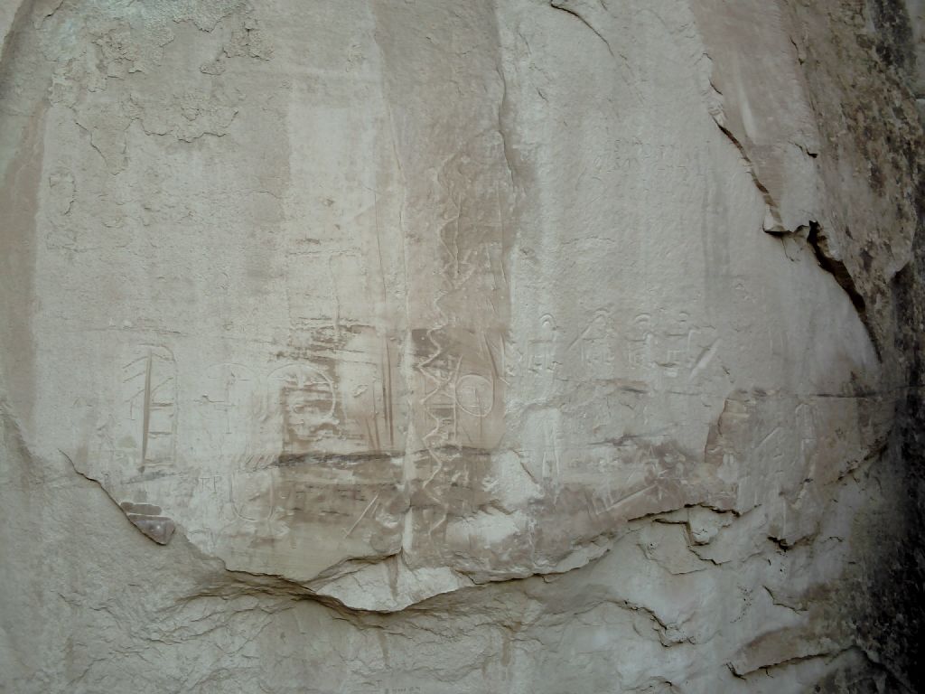

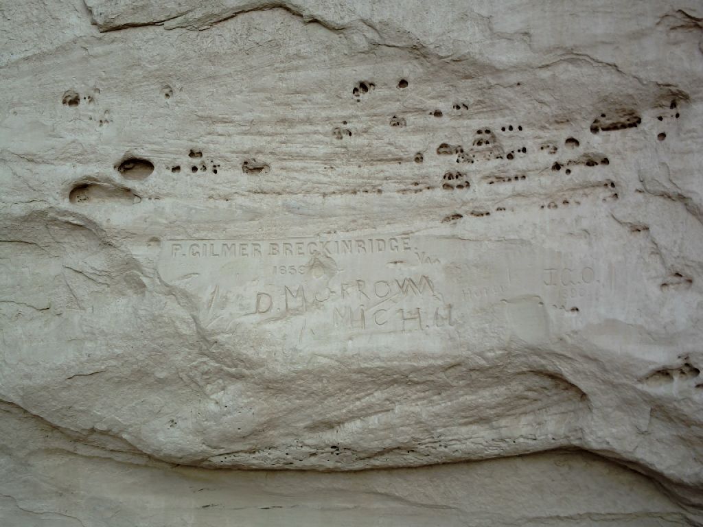
 Pictograph.. Spaniard 1609.. Soldier 1859.. Another Soldier 1866 .......In 1859 Breckenridge was the guy who took a herd of camels across the desert to try them out as pack animals - the mules won that battle. |
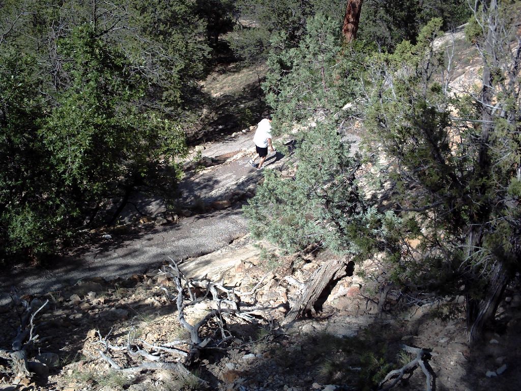
Third the rock is in the shape of a narrow horseshoe with an outer rim of the tall rocks maybe 300 feet across and a box canyon on the inside maybe 600 feet across. The hiking trail goes up one side, around the horseshoe and down the other side. It's a fascinating trail, up there in complexity and interest with the trails at Chimney Rock NC and Pinnacles CA. |
 There is a steep switchback climb to the top 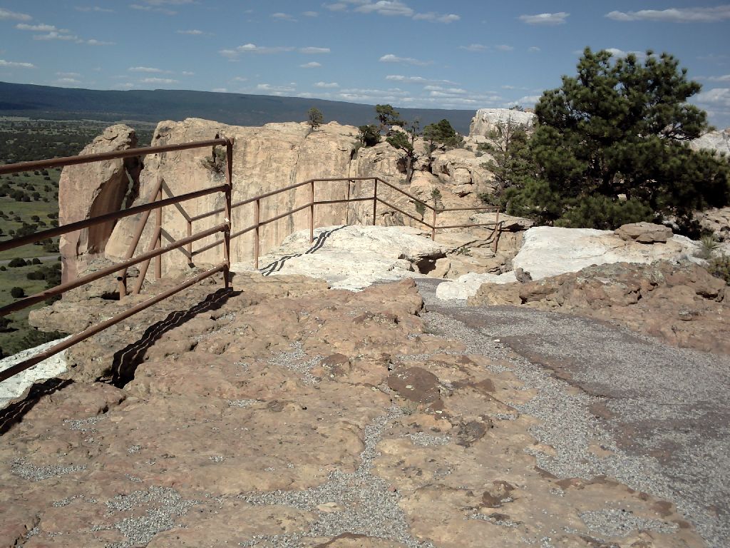 ...............
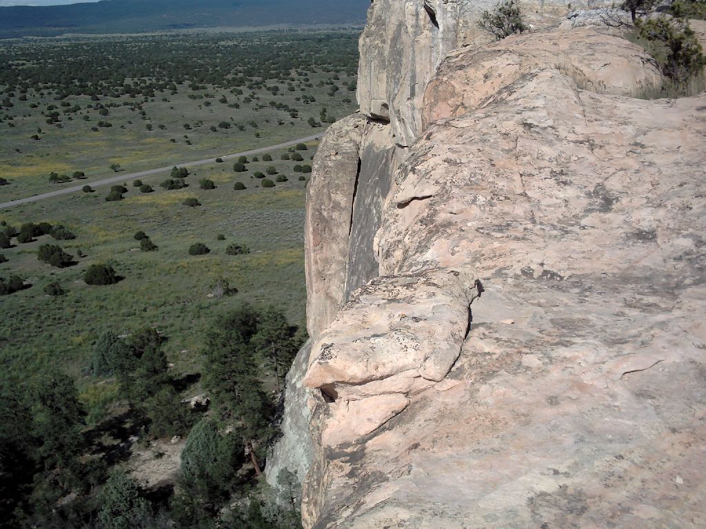 The edge is guarded......sometimes 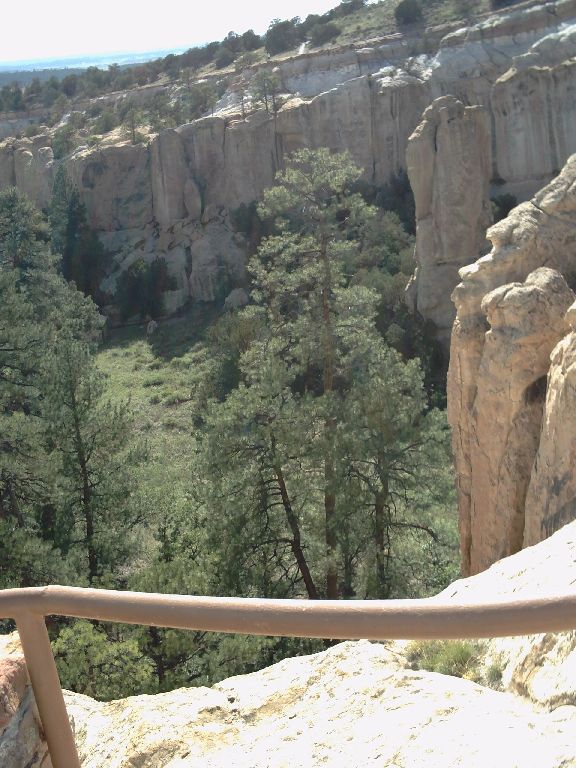 The Box Canyon is surrounded on three sides by the rock |
Last, the Indians built a village on top of the horseshoe! It had three-storey stone houses and about 1500 people. The water came from the pond and the tall houses acted like a castle for defence as well as being perched on the top of a very steep slope. |
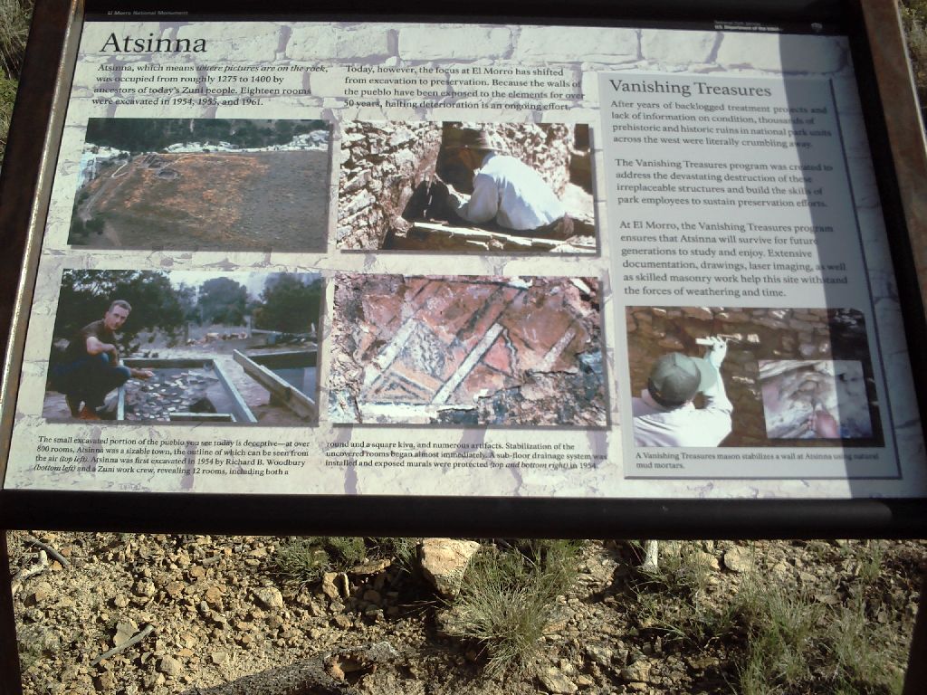 The Site. Atsinna means "place of writings on the rock" The Site. Atsinna means "place of writings on the rock"
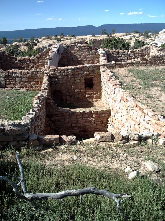 Condos Condos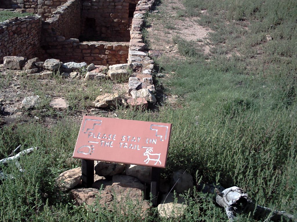 Ancient Pictograph(!) Ancient Pictograph(!)
|
Next morning, onward and upward. The upward part is to cross back over the continental divide that I had crossed the previous day to get to El Morro. At the top is the Bandera Volcano and Icecave. The usual pictures of an Abominable Snowman decorated the signs, but I wanted to check out the volcano. It was great. There was a cinder track leading up a few hundred feet to the side of the crater. The ice cave was ho-hum. This set-up was privately owned in the middle of the national conservation area. Presumably it was quite profitable and the ticket office proclaimed that it had been a trading post since the 1800s so I guess it was grandfathered in. |
|
| Next stop was the Grants Uranium Mining Exhibit. I had not known, but the area was a hotbed (!) of uranium exploration and discovery just after the Bomb was created. The museum had a basement that was tricked out as a mine. Quite good. | |
The road north from Gallup used to be Route 666. Apparently there were an abnormally large number of accidents on it and, of course, everyone blamed the 'mark of devil' route number. So it is now renumbered as Route 491. I haven't yet heard any reports that the number of accidents decreased. The goal for the day was Shiprock but when I got there the only campground was in a dirty, dusty river-bottom so I passed it up and kept on toward the North. After a few miles there was an Indian casino at Ute Mountain. It had a nice campground attached so I stopped. |
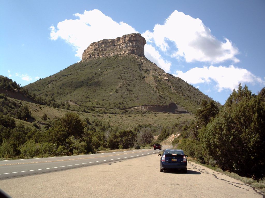
 Shiprock is visible for miles across the surrounding countryside. It was a major landmark for the wagon trains |
|
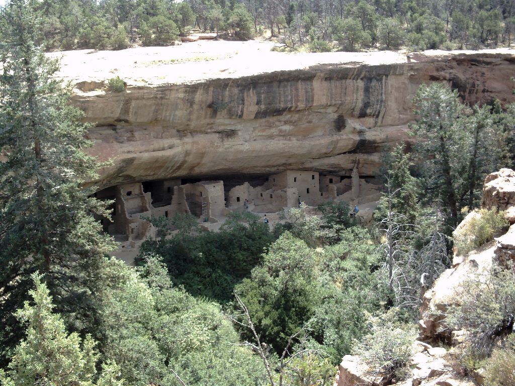
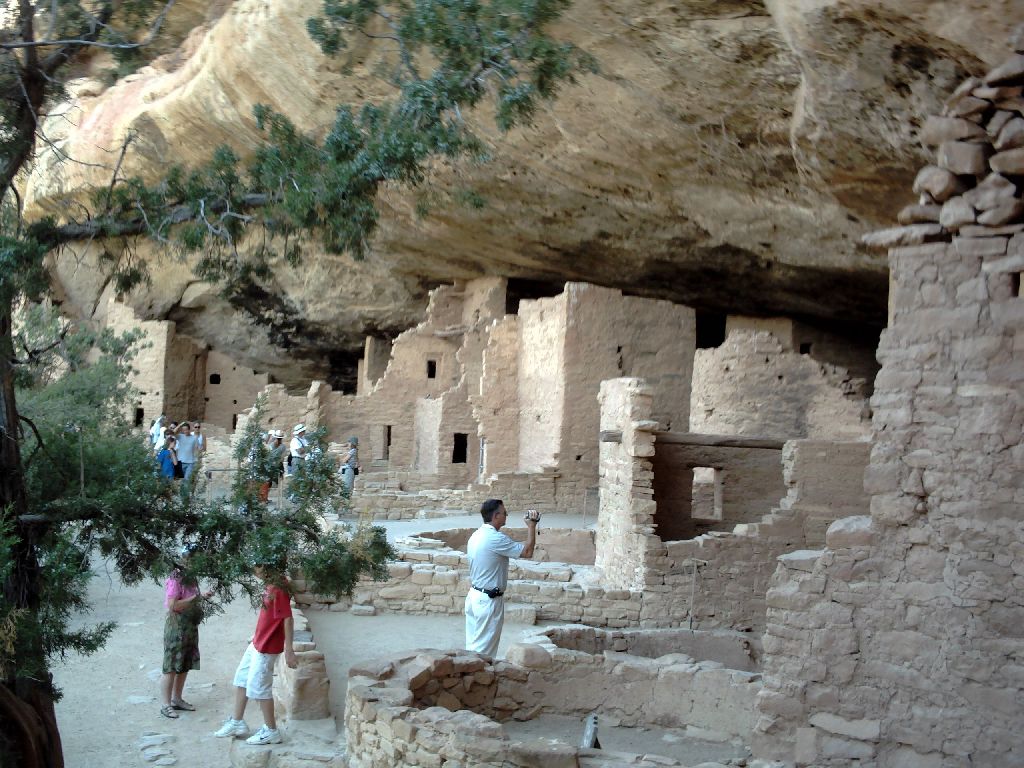
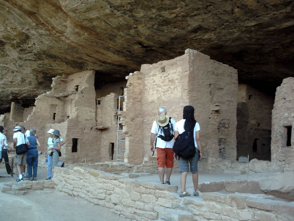
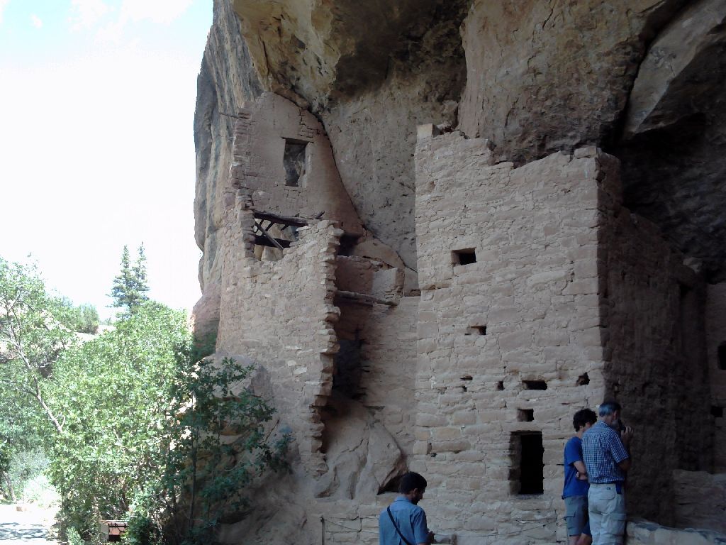
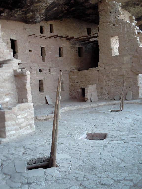
After Ute Mountain the next destination was Mesa Verde - the green table. This National Park is the best I have visited for Indian Ruins. I visited the Spruce Tree House. Later you will see the REAL gems - Balcony House and Cliff Palace... |

|
|
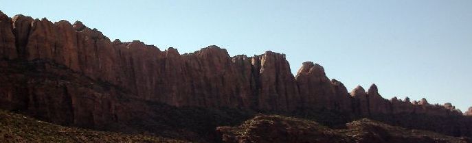
When we left the National Park the scenery kept getting better... |
 |
|
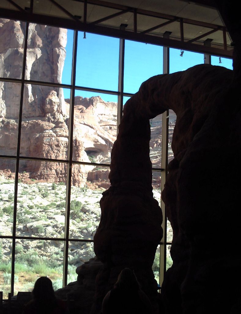
Moab is a spectacular sporting center - white water rafting, bicycling on the Slickrock formations, hiking, ...and Arches National Park. I camped in the town for three nights ready to go on the river for another three nights. The first thing do was to visit Arches.The visitor center was the first surprise - they had built a replica of Delicate Arch inside the building. |
 |
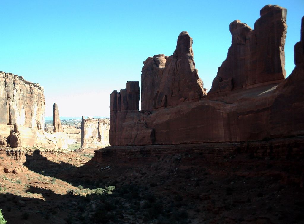
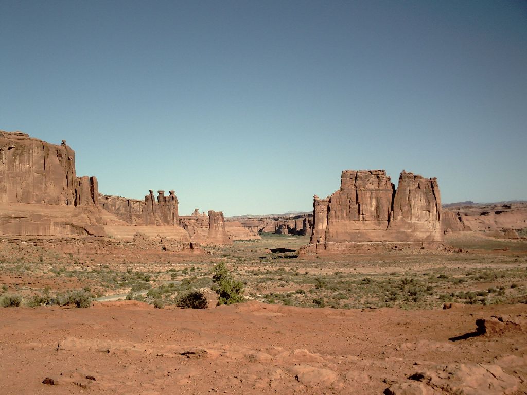
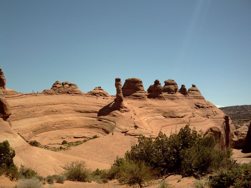
As I drove into the park, the second surprise was a miniature Monument Valley. This is called Park Lane and the Courthouse Towers |
 |
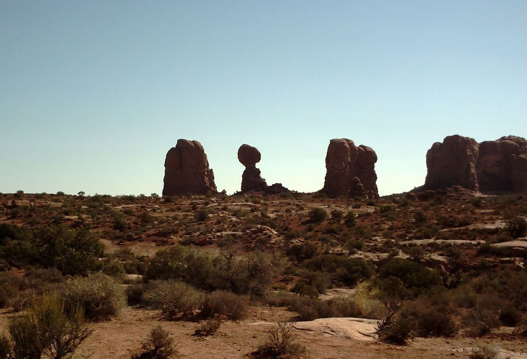
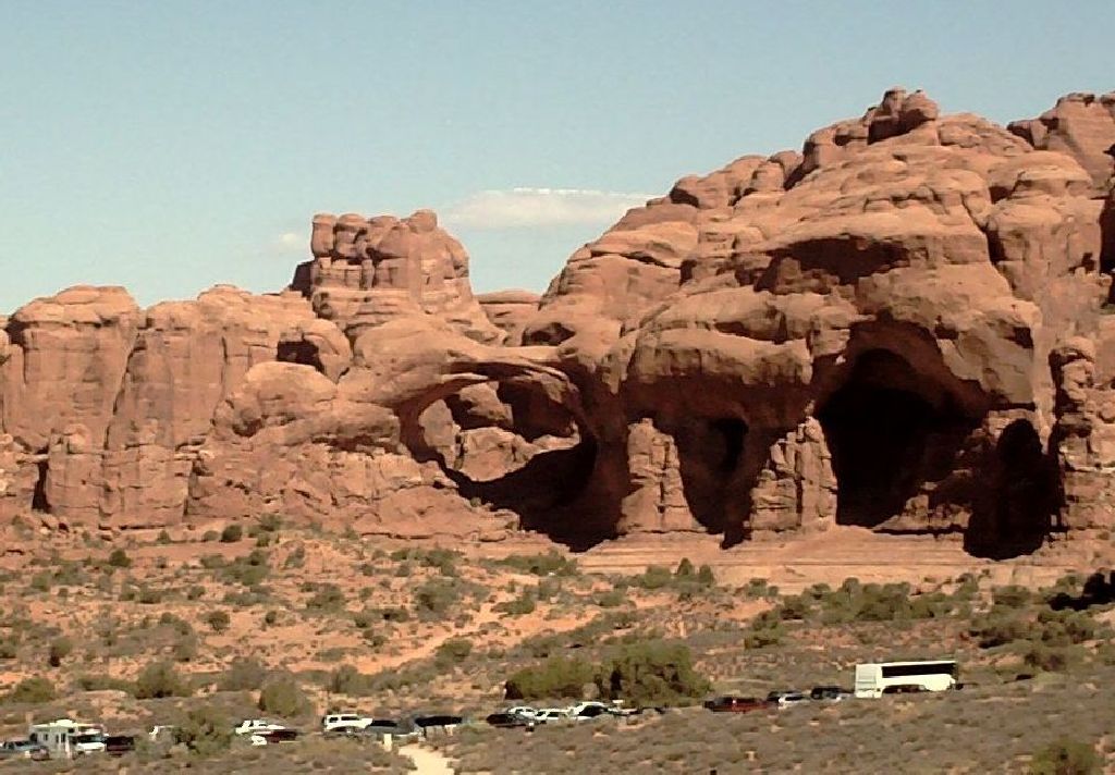
Moving on, I passed Balanced Rock on my way to the Windows Area. Here, I was lucky enough to find a Ranger Tour just about to start so I joined it and learned all about the desert scenery for an hour and where not to walk and why. As this was going on we also walked around the windows - also called the spectacles. |
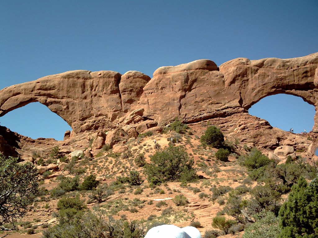 
 The view of the two eyes from the other side is totally different |
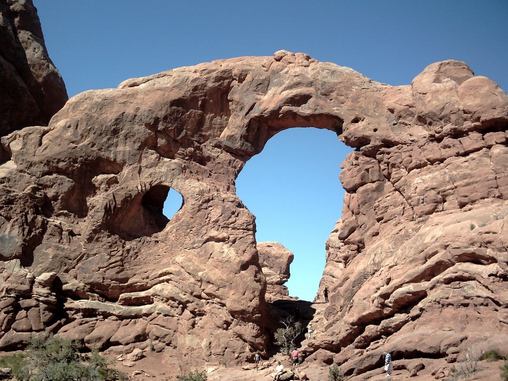
Across from the Spectacles is the twin arch which is where one of the Indiana Jones films was made |
 |
The main goal for the day was the Delicate Arch. This is probably the most photographed of the arches and was quite a hike. The trail starts at the Wolfe Ranch House. A farmer got fed up with the rain in the East so he came West and bought some land here. The next generation of the family came out in 1906 and were disgusted by his cabin and living conditions so they built him a new palace. Here it is. |
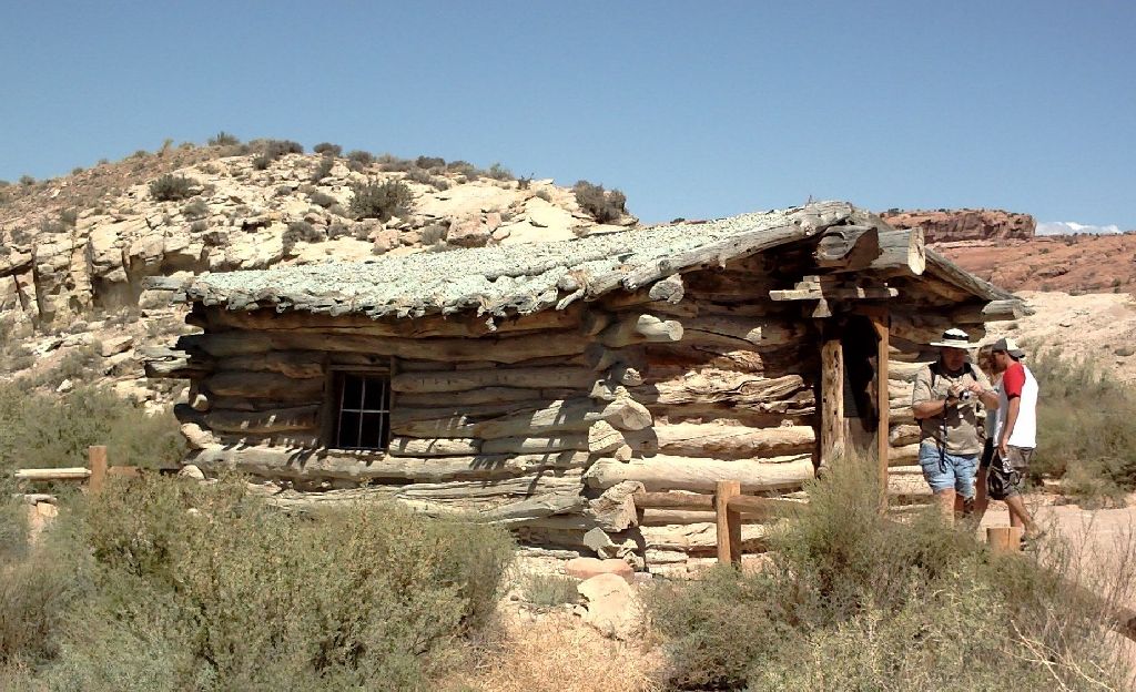 The palace. Anyone need a good Realtor? |
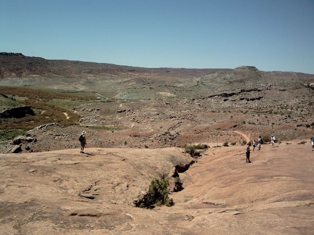
| After the palace there was an uphill walk of about a mile and a half. Note the trailhead carpark to the left of the center of the picture |
 |
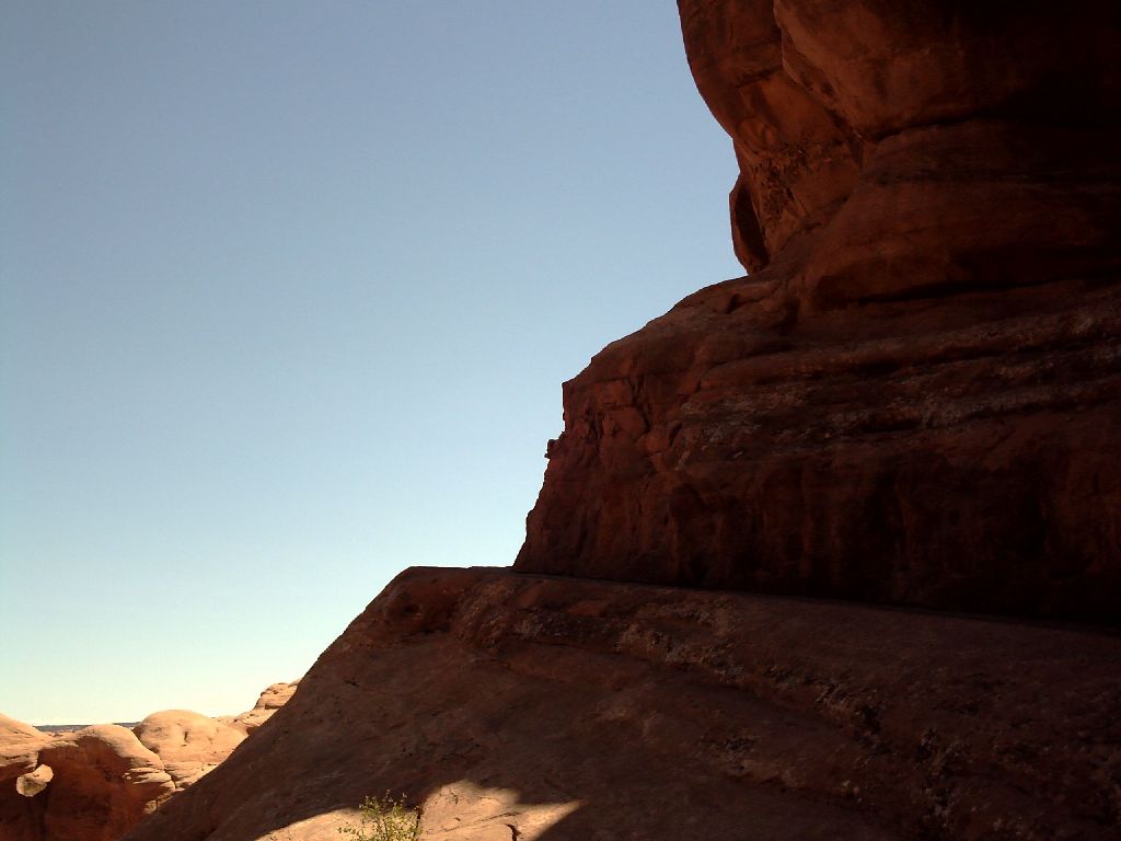
| The trail then went around a rocky ledge that went diagonally up the cliff with a significant drop-off to the left |
|
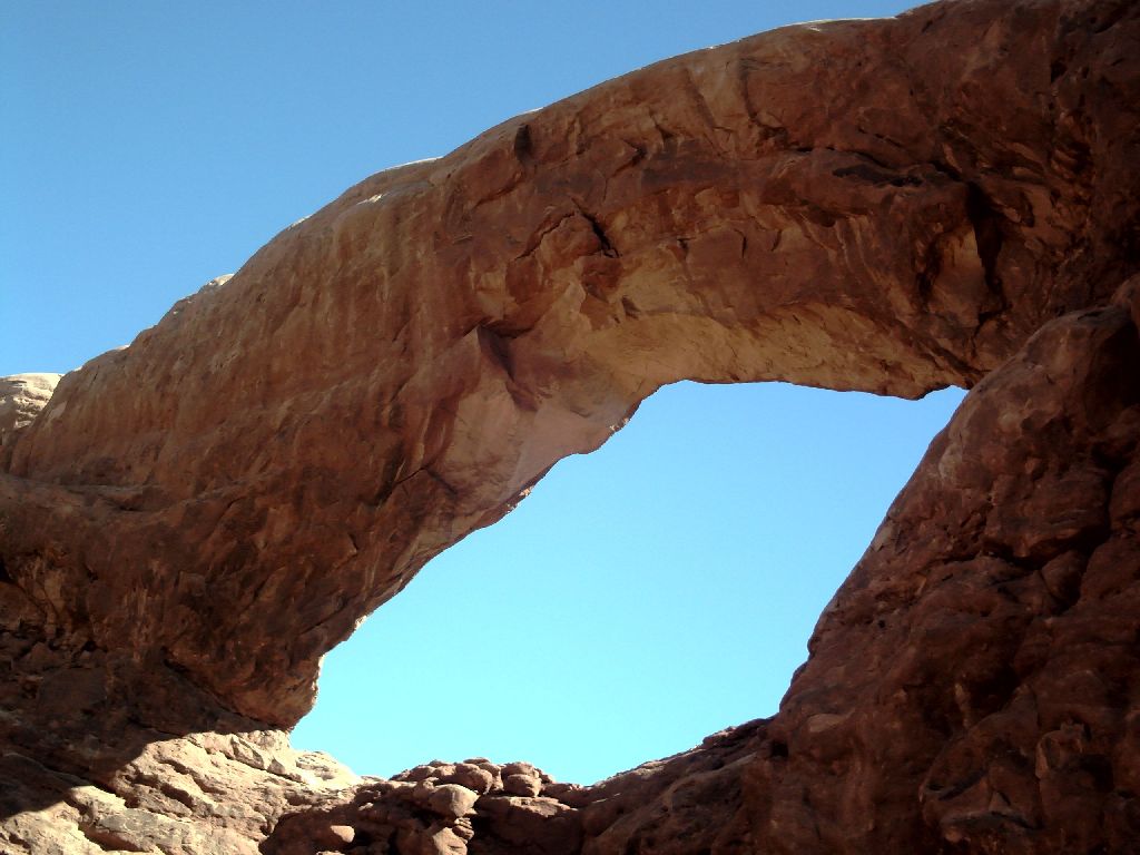
| Delicate Arch is poised on the edge of a cliff. Scores of people were there and there was even enough food to keep a raven happy |
 This is a general view from the NorthWest. If you can't make out the arch check the shadows!
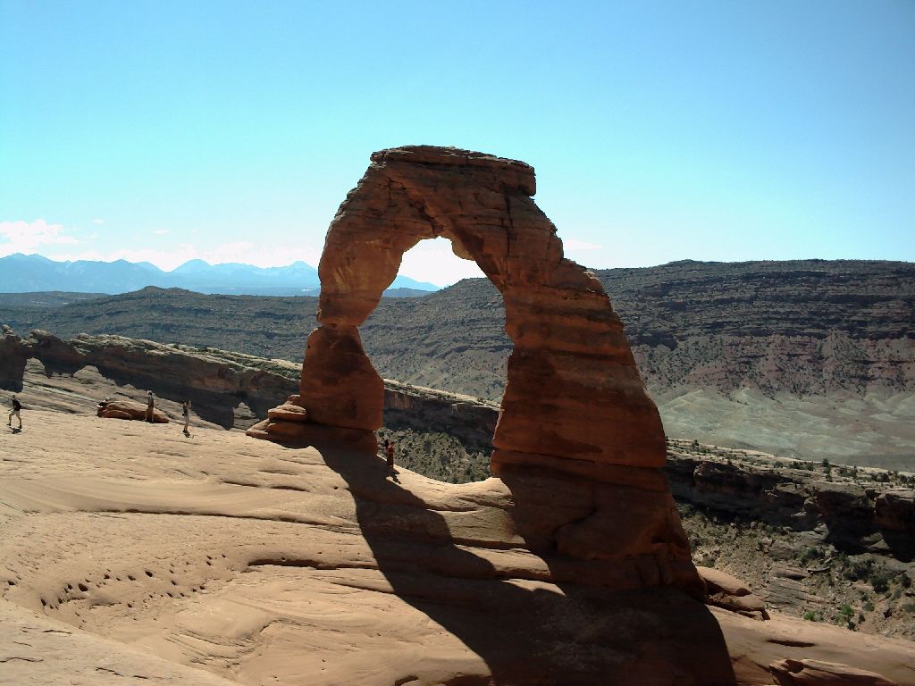 Here is the standard view. You will see this on most Arizona licence plates
 The southern view is totally different
 |
| On the way back to the trailer I took a 60-mile loop road that went up the Colorado River for a way and then looped back to town going half way up the La Sal mountains. A spectacular drive |
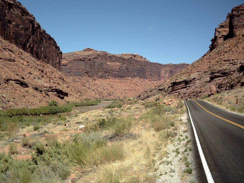 The river has carved its way through a gorge
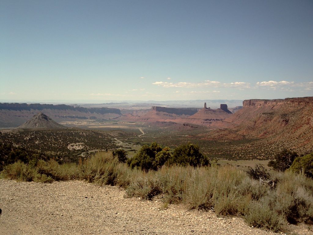 A side valley is Castle Valley
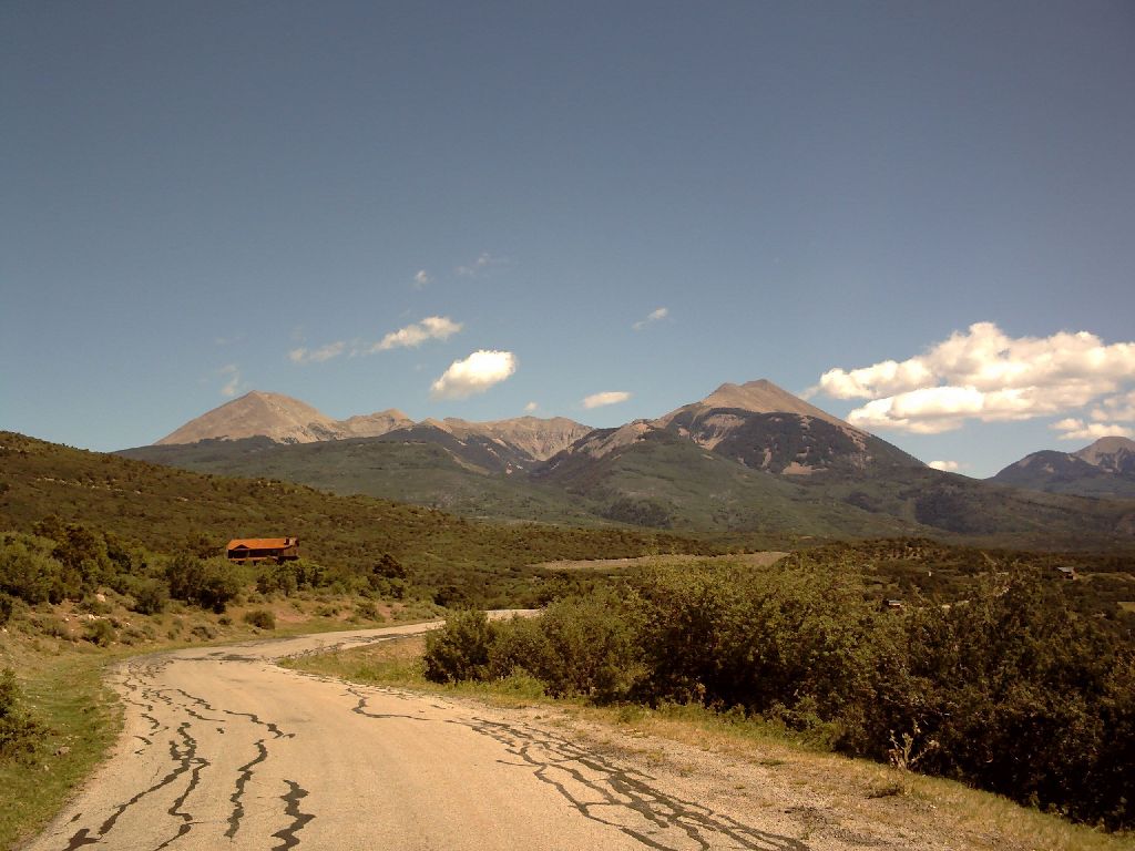 Leading up to the La Sal mountains
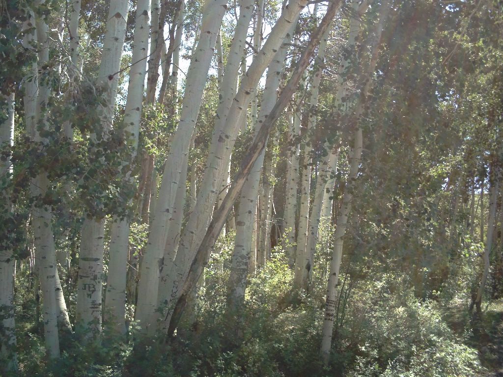 The flora change significantly as we get higher
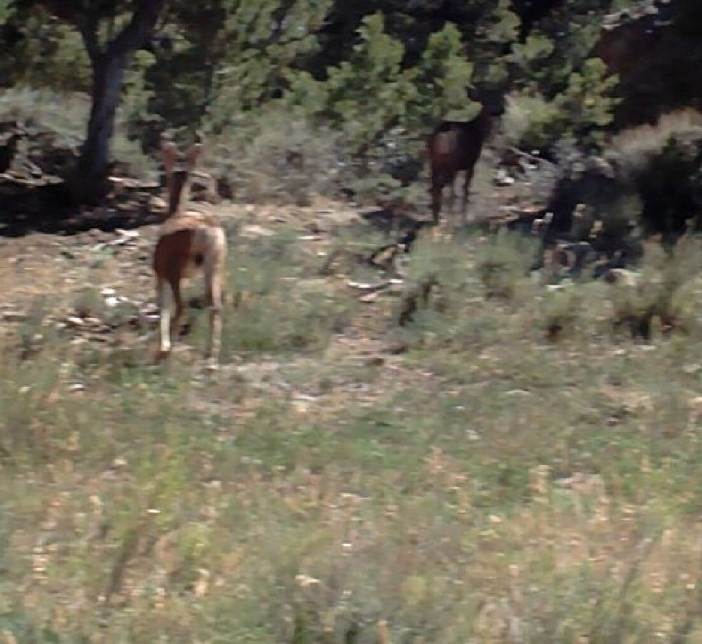 As do the fauna
|
|
Back to "Other Trips"
Next - "Rafting" On to "Moab to Vegas" On to "Vegas to San Antonio" |